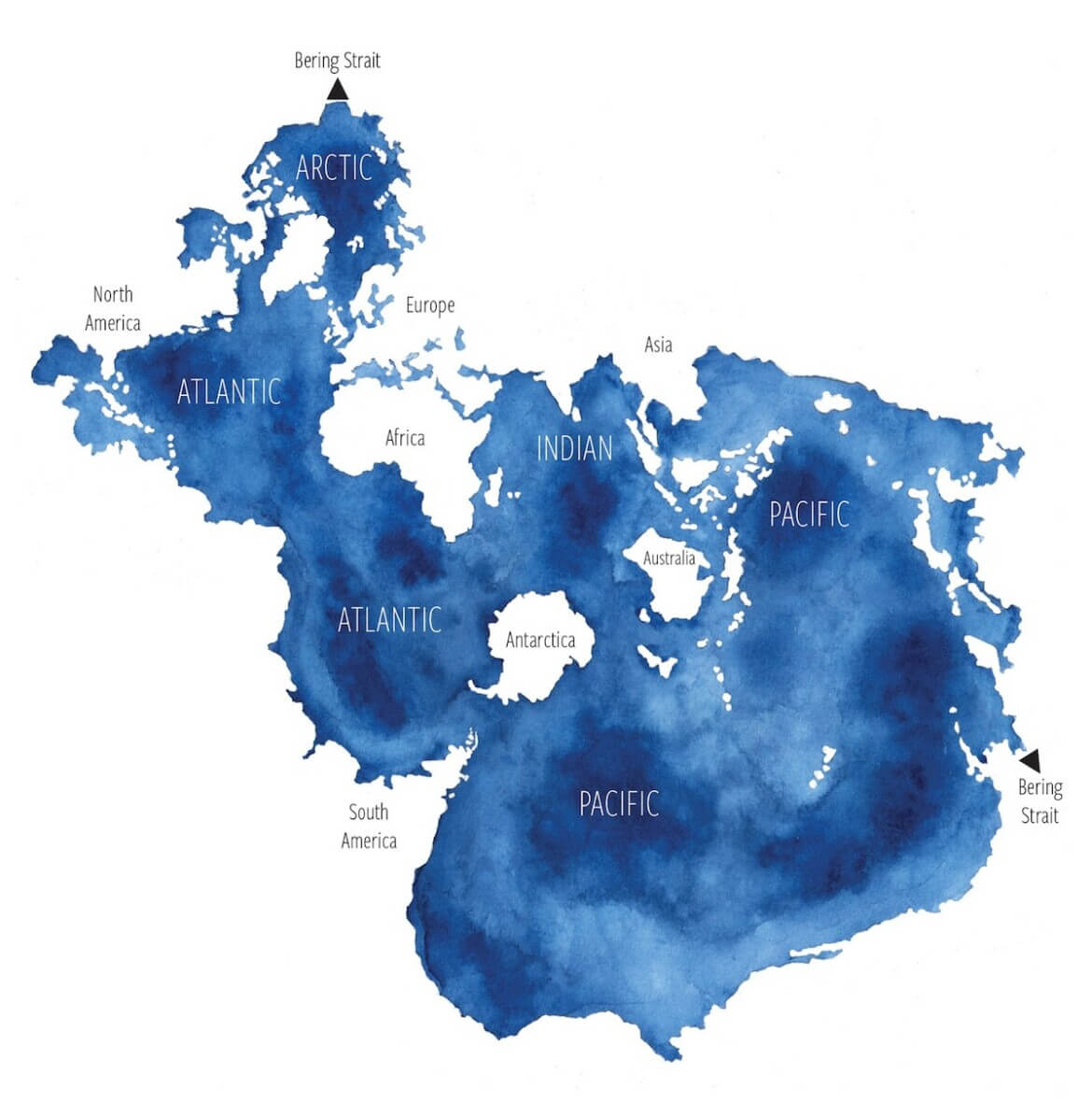
Today I stumbled across a beautiful view of the the world’s ocean(s) that shows us a beautiful truth about them. This map projection apparently had a moment of Internet fame in 2018, but I missed it. First developed in 1942 by Athelstan Spilhaus, a geophysicist and oceanographer, it centres on Antarctica and displays the oceans as single continuous body of water. Wow!
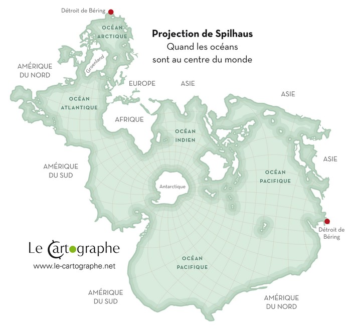
Like all projections of our planet onto a flat surface, something has to give to allow the cartographer to show us what is distorted by other projections. In this case, the continents are what’s broken up and distorted to give us this beautiful view of our blue planet. You can find out more at this article on ARCGIS. However, you’ll also find lots of interesting stuff just doing a web search for “Spilhaus projection.”